
Saturday, June 26, 2021
We were awake at 5:00 AM and on the road by 6:30 AM to head to our next to the last national park, Crater Lake.


We drove on Oregon route 138 that begins in Elkton to Crater Lake. This route runs along side the N. Umpqua River for a long way.


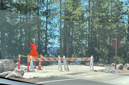
Route 138 has also been called the Highway of Waterfalls. We tried to see the waterfalls but there wasn’t a place to park an RV towing a car! At Clearwater Falls we turned on the road that said it was parking for RVs over 25 feet and then there wasn’t a place where you could park and then turn around. It was a fiasco getting out of there. We had to drive the car off the tow dolly, unhook the trailer and then Dave worked and worked to get us out of this tight space. We were both drenched with sweat and the mosquitos were swarming!

Where we turned! 
Turned around and ready to head on down the road!
The highway is surrounded by the Umpqua National Forest. As we were driving we saw MANY acres of burned forest! It was so sad to see the destruction from fires. We found online that this area was destroyed in 2017 by dry lightning strikes and over 64,000 acres of Umpqua National Forest.


Near Diamond Lake as we get closer to Crater Lake.

Crater Lake National Park was magnificent. What a place to visit! We entered through the North entrance which opened on May 28, 2021.

Crater Lake is famous for its deep blue color and water clarity. We took many pictures as we went around the rim of the lake. We were lucky that we were able to drive the entire rim and stop at all of the viewpoints (8 main viewpoints and 15 turnout vista points) because the East Rim Dr. opened on June 25th, the day before we arrived! The rim drive is 33 miles and loops around the caldera. Below is our first view of Crater Lake. We were awestruck!

Cleetwood Cove Trail is the only lake shore access. It is a very steep trail but it wasn’t open when we were there because of the snow and ice conditions that still existed.
As we drove along the Rim Drive we couldn’t believe how tall the snow poles were that measure how much snow the area received. There was still snow around the area.


Wizard Island was formed about 7,300 years ago when a newer volcano emerged!

Wizard Island in Crater Lake 
Wizard Island Close Up
Phantom Ship is an island that is a natural rock formation. We walked a trail up to the viewpoints to see this island. It got its name because it resembles a ghost ship. They said if it’s foggy or not much light it really looks like its name.


Pumice Castle in the Crater is another viewpoint that we viewed. We really had to follow the map for some of the viewpoints because they are not marked and Pumice Castle was one of those. It is made of orange-brown pumice rock. Its castle shape was formed because the rock around it has eroded away.


We spent hours hiking the trails that were open. There was a slight breeze and it was a sunny day!

Crater Lake is 1,943 feet deep. It is the deepest lake in the U.S. and the deepest volcanic lake in the world. The lake is fed by rain and snow!


The NPS (National Parks Service) app allows you to use your photos to make a postcard. It’s a cool feature! Here is one example.

A favorite photo from Crater Lake is the one below that looks like the lake is in a frame of evergreen trees!

Our campground for the night wasn’t far from the lake. In fact it was called Crater Lake Resort. Fort Creek runs through part of the park. We were informed that we were in luck because this evening a local band from Klamath Falls, OR. would be playing behind the store.

Crater Lake Resort 
Our campsite 
Where the band will perform. 
Fort Creek runs behind our campsite.
After dinner we walked over with our chairs to the lawn to listen to the local band called “Michael Quinn & Cherry Wine”. They mainly play music from the 60s and 70s with a few other decades mixed in.

Michael Quinn & Cherry Wine 
Enjoying the music 
The band
After the band finished playing we headed in because we would be having an early start!